Steall Ultra 50K
Steall Ultra is a mountain trail race on Saturday 19 September 2026 linking Kinlochleven and the Nevis Range. The route is approximately 47km long with about 3,100m of ascent and traverses the full length of the Mamores range, linking five Munro summits.
The course leaves Kinlochleven, climbs An Cumham and Sgòr Eilde Beag, follows the ridgeline to Mullach nan Coirean, then descends into Glen Nevis. It joins forestry tracks to the Ben Nevis visitor area, climbs the Ben Nevis tourist path to Lochan Meall an t-Suidhe, traverses beneath the north face to the CIC hut, and descends via Allt a' Mhuilinn, Leanachan Forest and the lower Blue Doon trail to finish at Nevis Range.
Terrain includes forestry tracks, technical rocky sections, mountain trails and runnable ridge sections. The route is fully waymarked and marshalled; participants must follow the established path at all times. A GPS tracker is issued at registration and must remain attached.
There is one fully marshalled support point in Glen Nevis at 31km offering drinks, sandwiches and snacks, plus toilets. Participants have 14 hours to complete the course and the race has an on course cut off at Glen Nevis Support Point at 18:30 with course closure at midnight. Recommended prior experience is a trail marathon with similar ascent and participants must carry a secondary navigation system and the mandatory kit listed by the organiser. Visit the organization's website for the most recent information.
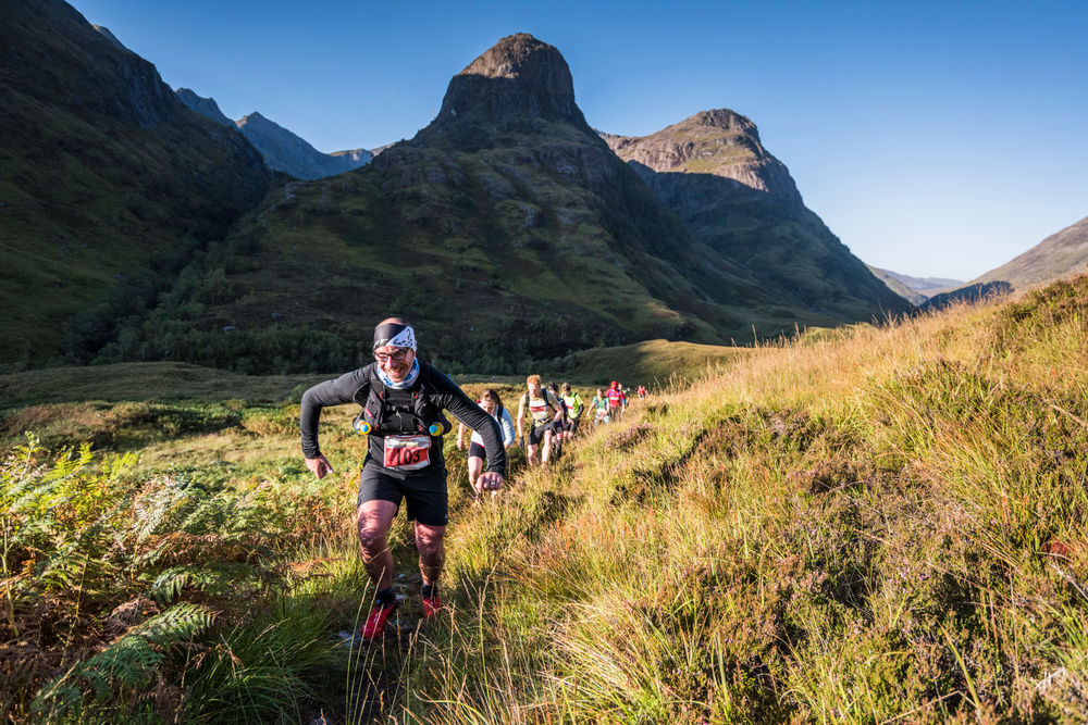
About the Route
This race route traverses the full length of the Mamores range, an iconic mountain ridge, linking 5 Munro summits. After an exciting start, weaving through the streets of Kinlochleven, the route climbs steeply up An Cumham via excellent mountain trails, to overlook Loch Eildhe Mor. A steep climb up a good stalkers path leads up to the first summit on the ridge, Sgor Eilde Beag. From here a mix of technical rocky ground and grassy trails lead across the mountain summits all the way to the western end of the ridge at Mullach nan coirean. A fast runnable ridge then leads the way down into the forest in Glen Nevis before joining forestry tracks leading the Ben Nevis visitor centre and the Aid station. The route now joins the Ben Nevis tourist path, rapidly climbing again to Lochan Meall an t-Suidhe (otherwise known as the ‘Half Way Lochan’), before traversing under the towering north face cliffs of the Ben to the CIC hut. Descending via the main Allt, a ‘Mhuilinn track takes runners towards Leanachan Forest and excellent tracks that eventually connect with the lower section of the Blue Doon MTB downhill track. It is steep and unrelenting, with banked turns leading to an amazing finish at the Nevis Range
The entire route is runnable for skilled off-road runners and features a mixture of forestry tracks, technical rocky sections, mountain trails and paths. The entire route is mandatory and will be comprehensively waymarked during the race. At all times, runners must follow the established path and marked route without deviations, such as cutting corners in zig-zags paths, or taking a direct line between two points. Failure to observe these rules during the race will result in disqualification. If you are recce’ing the race route in advance of the race, we kindly request that you always stick strictly to the established path on the ground.Participants have no special right of way over other recreational users and are reminded to be polite and courteous at all times.
Distance and Height Gain
The route is approximately 47km with 3,100m of ascent.
What Previous Experience Do I Need?
We recommend having had completed a trail race of marathon distance with equivalent height gain (1500m ascent) before race day. The course will be fully way-marked so whilst navigation experience is desirable, it’s not essential for this event.